
6 Ways How Agriculture Satellite Imagery Builds and Bolsters Food Security
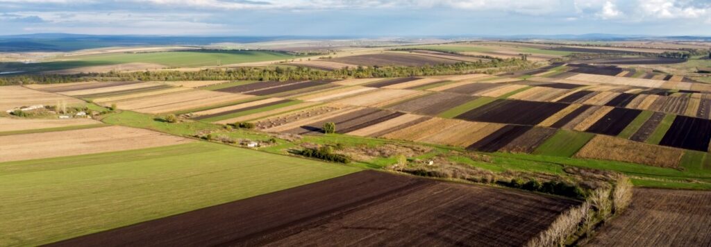
Agriculture satellite imagery is charting new and efficient pathways for agricultural growth. Satellite imagery in agriculture is turning out to be a valuable asset powering and optimising the day-to-day agricultural activities. It offers the opportunity to employ a data-driven approach and bring more precision into a number of agricultural activities. The use of satellite images can also expedite the gathering of farm data to evaluate various agricultural parameters seamlessly.
Agriculture satellite imagery can be a differentiating factor for the agricultural sector. From predicting the weather conditions to providing accurate yield estimates, agriculture satellite imagery analysis can fortify your farm planning practices. It can also be beneficial in refining your water management practices to ensure more sustainability.
With agriculture satellite imagery, research and development procedures can be optimised for identifying efficient and productive agricultural operations. By integrating with IoT devices and determining adequate agrochemical requirements, it can also power your precision agriculture efforts. Following are the top 6 reasons that explain why agriculture satellite imagery has the potential to transform the agriculture landscape.
1. Achieving Sustainability is Now Simpler With Tech-driven Irrigation
Sustainable water management is the need of the hour. Judicious use of water is essential not only to ensure costs savings for agribusinesses but also to prevent over or under irrigation. Optimal water utilisation also has a positive influence on crop quality and productivity. Improving agricultural water management efforts is thus essential for a sustainable and productive agriculture future.
Agricultural remote sensing satellites can enable agribusinesses and farmers to remotely monitor large crop-areas quite easily. It can provide producers with estimates about water demands across their farms. This can help them assess and determine adequate water requirements per plot. Irrigation planning and management can also be simplified and made more efficient with the help of satellite imagery analysis.
2. How Satellite Images Encourage Enhanced Climate-resilience
Extreme weather events such as floods, droughts, or untimely rains can have a significant impact on the quality of crops. Having prior knowledge of upcoming weather events is necessary for farmers to be prepared and take necessary preventive measures. This gives them the best chance of protecting their crops or alleviating the intensity of crop failures.
Satellite imagery can be an efficient way to monitor climatic conditions and predict weather disasters. The use of satellite images and data could be useful in charting an efficient plan of action that mitigates the impact of weather events on agriculture. This way, by providing insight into the fluctuating weather patterns, satellite imagery can help producers to pave the way for climate-resilient agriculture practices.
3. Controlling Agrochemical Usage to Cultivate Healthy Crops With Agritech
Pest infestations and crop diseases can be a major cause of concern for agribusinesses and farmers. Agrochemicals such as fertilisers and pesticides are used to eliminate these issues and improve crop yields significantly. However, the requirement of these chemicals varies for each crop and plot. Inadequate use of these chemicals can affect crop health and also hamper the nutritional value of the soil beneath.
Satellite data can be utilised to determine accurate agrochemical requirements for specific parts of a field. This can minimise the use of chemicals, thereby ensuring the sustainable cultivation of crops. Moreover, by strengthening pest management efforts, agriculture satellite imagery can also mitigate critical food security concerns and bring down crop failure incidents.
4. Satellite Imagery-IoT Integration Powering Precision Agriculture Practices
Precision farming practices help in optimising a farm’s efficiency through intelligent resource utilisation. With precision farming, agribusinesses can witness considerable savings on seeds, water usage, pesticides, and many other agricultural inputs. It can also aid more informed and data-driven decision making to significantly boost the quality and productivity of agricultural outcomes.
The satellite imagery-IoT integration involves the combination of high-resolution images with smart devices. Agricultural drones can utilise reliable crop information from satellite images to carry out the process of fertiliser spraying precisely. The seeding function can also be streamlined and made more precise by using agricultural robots in coordination with satellite images.
5. Driving Innovative Agricultural Discoveries With Advanced ERP
Through effective research and development (R&D), agricultural stakeholders always focus on discovering new ways to boost crop productivity. Agricultural R&D can be a powerful tool to upgrade agricultural resilience and promote food security efforts through improved farming practices. The use of satellite images can provide vital insights into various crop and field parameters and make agricultural R&D practices a lot more efficient.
Agriculture satellite imagery can be beneficial in monitoring and assessing critical soil health and crop productivity patterns. Issues pertaining to climate change, pest attacks, crop diseases can also be analysed with agriculture satellite imagery to define various crop failure trends. This can help R&D efforts in charting smart agriculture procedures that increase crop yields while also minimizing inputs.
6. Satellite Imagery Fortifying Farm Planning Through Yield Estimations
Accurate and quick estimation of crop yields can be of vital importance for agricultural stakeholders. It can be helpful for agribusinesses in improving their agricultural planning and management efforts. Smart agritech solutions can simplify the yield estimation process and promote timely decisions related to agricultural imports and exports.
The integration of agriculture satellite imagery with an ERP platform can simplify the detection of vegetation, moisture, micronutrient stress, etc issues. This can help in making accurate estimates of yields. With crop-specific yield estimates, agriculture satellite imagery can strengthen the procurement and storage plans of agribusinesses. Moreover, these estimates can also assist insurance companies in determining future crop conditions efficiently.
FarmERP’s satellite imagery analysis expertise can provide you with detailed field-level insights to carry out agriculture practices more efficiently. Monitor crop trends and ensure better soil health with FarmERP’s agriculture satellite imagery support. Contact us to know more about how our farm management platform can enhance the effectiveness of your agriculture functions with satellite imagery analysis.