
How GIS in Agriculture is Promoting Precision Farming
The agriculture industry has long been a mainstay for the economy of several countries around which socio-economic privileges and deprivations revolve. Broad and sustainable agriculture is necessary to raise living standards, assure food security, alleviate poverty, generate a buoyant market for industrial expansion, and contribute to the national economic growth.
However, for today’s governing bodies, the need to secure the essential food sources to support the unprecedented increase in population has been a growing concern. Poor farming techniques and lack of awareness have plagued the agricultural community for centuries. Additionally, changes in temperatures and weather patterns, mainly due to climate change, can now alter the course of various environmental phenomena such as floods, droughts, pest infestations, and soil erosion.
In recent times, improvements have been made in agriculture development to ensure the safety and gains of crops worldwide. A myriad of advanced and sophisticated tools and technologies are also emerging in the sector which is cost-effective and relevant to specific areas, conform with the natural climatic regime of an area, enable efficient management practices, and provide better results.
GIS to Define the Future of Agriculture with Historical and Real-time Data
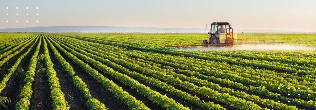
As sensors on satellites, farm machinery, and fields, unmanned aerial vehicles, GPS, and robotic technologies advance, several tasks in farms have now become automated. Precision agriculture in general and geographic information systems (GIS) in particular are essential components of automated field operations.
Precision farming requires spatial data, including an analysis of spatial variability, and simulation models to classify the processes that occur and make informed decisions. GIS is a system that stores, analyses, and displays spatial data through various technologies to improve farm operations and management.
Applications of GIS in Agriculture
GIS can analyze current data combined with historical farming practices to determine the best crops to plant and how to maintain water and nutrient levels to best benefit the crops. Let’s look at various uses of GIS in agriculture and how it encourages precision farming.
1. Soil and Agricultural Mapping
GIS enables the identification and classification of soil and provides soil characteristic maps that give important insights for understanding whether or not a crop will grow successfully in an area. Soil mapping of various themes such as pH levels, internal drainage, salinity, and multiple aspects of soil chemistry can help retain soil nutrients and earn maximum yield. Soil mapping with GIS is also critical for preventing environmental deterioration due to misuse of land.
GIS in agriculture helps farmers map and project future fluctuations in several parameters such as temperature, precipitation, and crop output to build more effective farming techniques. Agricultural mapping is a growing area of GIS that allows farmers to take more corrective actions in terms of fertilizer use, pest treatments, and protection of natural resources for improved food production.
2. Crop Health Monitoring and Pest Control
GIS in agriculture manages, analyses, and maps all types of data collected from remote sensors and sensors mounted directly on farm machinery and in fields. This eliminates the need to manually check crop health across multiple acres of fields. Data on previous crop yield can be paired with satellite images to assess environmental conditions such as terrain specifics, air temperature, and surface conditions. Additionally, harvesters equipped with GPS tracking units can help measure crop yield as well as crop quality values such as chlorophyll levels and plant water content. GIS can improve the analysis of these data to help farmers determine which crops require more attention.
Based on temperature monitoring through imaging sensors on satellites and air vehicles, farmers can today detect and prevent the invasion of harmful insects and pests with timely alarms. To further these capabilities, agricultural companies are developing neural networks and training them with AI and deep learning algorithms. This training enables the network to learn and find samples indicating pest infestations in the early stage. In this way, GIS can encourage the implementation of smart pest management measures to ensure excellent protection from pests and diseases.
3. Irrigation Control and Water Management
Another important use for GIS in agriculture is the management of natural resources, especially water. To facilitate effective irrigation management, GIS mapping software provides insights into water stress in each crop and patterns of water shortages through visual representations of data.
The combination of these insights with water delivery maps enables the better management of water resources while improving the quality of crops. Using GIS, farmers can also determine whether the rainwater is draining slowly or quickly and take necessary steps to reroute its flow.
4. Disaster Control and Management
GIS in agriculture paired with data pools provide environmental insights that enable the prevention, analysis, and mitigation of negative impacts of destructive natural calamities such as flood, erosion, and drought. In terms of the flood, GIS performs flood inventory mapping through past flood data, satellite images, and field surveys to identify the areas susceptible to flooding and helps farmers take preventive measures.
GIS software equipped with remote sensor data is also integral to creating maps indicating land susceptible to soil erosion and soil deterioration in crop yields. GIS in agriculture is further used to mitigate the effects of droughts with data on soil moisture conditions resulting from rainfall, water runoff, and evapotranspiration. This way, data captured through GIS can be used to carry out climate-smart agriculture practices and mitigate the risks of extreme weather events.
5. Farming Automation and Strategic Planning
GIS is set to be the key to futuristic farming automation. Today, smart machines and equipment are used on farms to replace various manual and time-consuming tasks. The integration of GIS into these machines is expected to enable the early detection of any changes in the field and the timely execution of necessary actions with the right tool.
GIS in agriculture also contributes to strategic planning as it provides a combination of map layers to address different types of agricultural problems in real-time. With insights into soil properties, average rainfall, irrigation needs, and more, GIS enables agribusinesses to identify the most efficient and cost-effective ways to use their fields and improve yield.
FarmERP, a farmer management system specializes in offering the most advanced yet affordable modern farming solutions to agribusinesses for climate-smart and precision farming. Get in touch with us to know how we help agribusinesses achieve their goals with GIS.