
Geoinformatics for Precision Agriculture: Why It Matters in 2025 and Beyond
Agriculture is no longer solely dependent on instinct, experience, and manual labour. As global food demand grows and climate challenges intensify, the shift from traditional to technology-powered farming is not just a trend—it’s a necessity. At the heart of this transformation lies data: real-time inputs and actionable insights that help agribusiness make smarter decisions.
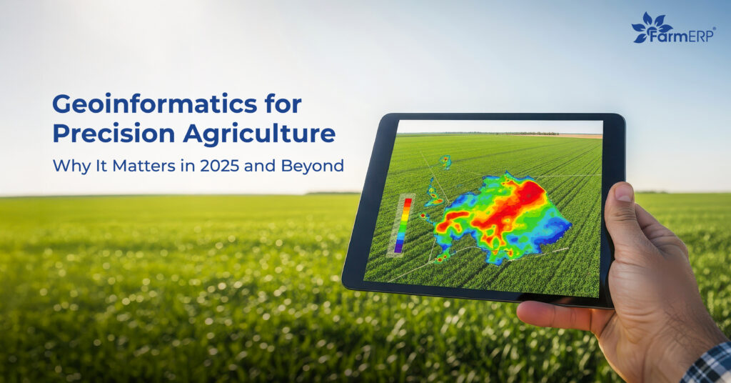
Among the most impactful technological tools reshaping modern agribusiness is geoinformatics. This integrated approach uses GIS, GPS, and remote sensing to manage agricultural land with pinpoint accuracy.
The geoinformatics use in precision agriculture is enabling agribusiness to maximise yields, reduce inputs, and adapt to changing environmental conditions with confidence.
What Is Geoinformatics and How It Supports Agribusiness?
Geoinformatics is a multidisciplinary field combining geospatial technologies like Geographic Information Systems (GIS), Global Positioning Systems (GPS), and remote sensing to collect and interpret location-based data. In agriculture, this translates to detailed insights on soil quality, crop health, weather patterns, and more—delivered in real-time.
While geodesy focuses on the measurement and representation of Earth’s shape and features, geoinformatics goes a step further by applying this spatial data to solve practical problems—like where and when to plant, irrigate, or apply fertilizers.
For instance, an agribusiness using geoinformatics can monitor crop health across large fields through drone imagery, detect nutrient deficiencies using NDVI (Normalized Difference Vegetation Index), or map soil moisture levels via satellite data. This results in more precise interventions and better outcomes.
Key Use Cases of Geoinformatics in Precision Agriculture
Land Mapping & Soil Health Monitoring
GIS-based zoning helps identify the best crops for specific plots by analyzing soil types, nutrient levels, and topography. This promotes efficient land use and sustainable farming.
Variable Rate Application (VRA)
With the geoinformatics used in precision agriculture, agribusiness can guide farmers to apply fertilizers, pesticides, and water exactly where and when needed. This not only cuts costs but also minimizes environmental impact.
Crop Monitoring & Yield Estimation
Remote sensing tools like satellite imagery and drone surveillance allow for constant monitoring of crop health. NDVI indices can identify stressed areas early, enabling quick corrective action and accurate yield forecasting.
Weather Forecasting & Climate Adaptation
Geospatial weather models, combined with GPS data, offer hyper-local climate predictions. Agribusinesses with Farmers can plan sowing, irrigation, and harvesting schedules based on real-time forecasts, reducing risk and boosting productivity.
Role of GIS and GPS in Smart Farming
The integration of GIS and GPS plays a central role in smart, data-driven agriculture. Here’s how:
1. Data Collection
Sensors, drones, and satellites gather real-time data on soil conditions, crop growth, and weather.
2. Data Storage
GIS platforms store spatial and temporal data, creating a historical database for trend analysis.
3. Data Analysis
Advanced algorithms analyze the collected data to detect patterns and anomalies in farm performance.
4. Visualization
Agribusinesses receive data visualizations via heat maps, 3D models, and dashboard interfaces, making insights easier to interpret.
5. Decision-Making
The combination of all the above supports better decisions on irrigation, fertilization, harvesting, and field rotation strategies.
Meanwhile, GPS enables geo-tagged planting, tracks equipment movements, and provides real-time field visibility—especially useful for large-scale farming operations.
Benefits of Geoinformatics for Agribusiness
Increased Productivity and Efficiency
One of the most powerful outcomes of the use of geoinformatics in precision agriculture is the significant boost in farm productivity. Studies published on ScienceDirect have shown that leveraging geospatial data and analytics can lead to yield increases of up to 74.4% in certain crops—by guiding optimal input use, planting times, and intervention strategies.
Enhanced Sustainability
By enabling precise application of water, fertilizers, and pesticides, geoinformatics reduces resource overuse and environmental impact. This targeted approach supports soil health, conserves water, and contributes to long-term agricultural sustainability.
Improved Traceability
With advanced geospatial tracking, agribusinesses can now trace every input and output with precision. This supports compliance with global ESG (Environmental, Social, and Governance) standards and carbon reporting requirements.
How FarmERP Leverages Geoinformatics
At FarmERP, we believe that the future of agriculture lies in smart data. That’s why our FarmERP Agribusiness Cloud integrates the power of GIS in precision agriculture to transform the way enterprises manage their operations.
Our platform provides a unified, B2B technology solution designed to help agribusinesses grow tenfold. By combining GIS, smart device integration, and predictive intelligence, we empower farms to make data-backed decisions—from crop planning and yield forecasting to pest and disease control.
This aligns directly with our vision of productivity, predictability, and profitability, ensuring our clients are not just keeping up with the industry—but leading it.
Future of Geoinformatics in Agriculture
The next wave of innovation will come from the fusion of AI and geospatial data. Machine learning models are being developed to create predictive systems that can alert agribusinesses before a disease outbreak, or recommend exact planting schedules based on weather and soil data.
In a world grappling with food security and climate change, the use of geoinformatics in precision agriculture will be vital in driving scalable, sustainable, and adaptive solutions for farming communities globally.
Final Thoughts
Geoinformatics is no longer just a competitive edge—it’s becoming a foundational pillar of modern agriculture. From improved yields to environmental stewardship, its impact spans every corner of the agribusiness value chain.
If you’re looking to integrate GIS in precision agriculture into your operations, our platform FarmERP offers a powerful, ready-to-deploy solution designed for your agribusiness growth.
Schedule a Demo with FarmERP and take the first step toward transforming your agribusiness with precision, performance, and purpose.