Agricultural Data Collection: Understanding Agritech’s Role in Gathering Farm Data
Agriculture has traditionally been an intuitive area with wisdom passed down from one generation to another. However, today’s problems such as climate change, depletion of arable land, and reduced resources are becoming more complex. There is also an urgent need to produce more food for the global population which is increasing at an unprecedented rate.
Farmers are facing an ever-changing world: the seeds that worked for generations may not work today as climate change worsens resulting in soil degradation and water constraints. In such cases, these farmers can no longer rely on generational knowledge and historical calendars to influence decisions about purchasing seeds to plant and fertilisers to use. They require more timely and responsive support.
Fortunately, technological advancements, the rising integration of computer software in farming operations, and agricultural data collection are helping in providing the answer.
The Importance of Data Collection in Agriculture
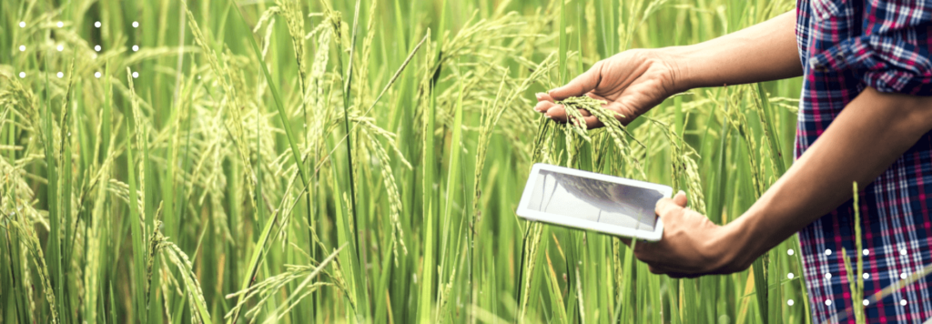
Field data tracking helps farmers better manage their operations. With the availability of a wide range of data and more information, they can make decisions that are tailored to the specific needs of their farms. The information obtained from various sensors and systems and their in-depth analysis can also help farmers in identifying inefficiencies that result in higher productivity and profitability, optimised fertiliser use, and lower input costs.
When farmers know more about their farms through agricultural data collection, they have more opportunities to strengthen their supply chain relationships. Data and its management provide farmers with the ability to eliminate volatility and risks. This does not only work to the advantage of the grower but also the supplier, thus allowing them to work together on a long-term basis. Furthermore, farmers who rely on agricultural data collection and analysis can help retailers and agricultural companies increase the transparency of their ingredients.
Data collection is also becoming important for farmers to approach resource conservation at a wide scale rather than at the farm level. This gives more opportunities to work with other field experts, especially at a watershed scale, to make information about conservation priorities.
Role of Agritech in Agricultural Data Collection
Technologies used in precision agriculture allow the collection of large amounts of data to measure resources and inputs such as water, fertilisers, chemical controls, or seeds and quantify results from both. Today, various types of farm machinery and equipment are integrated with some form of precision agriculture component technology for data collection.
IoT – The Foremost Key to Efficient Agricultural Data Collection
The integration of high-precision positioning systems like GPS, geo-mapping, IoT sensors, and electronic communication systems in agricultural machinery help collect a large amount of data, as well as navigate and position the machinery from anywhere with higher accuracy. Creating maps or geo-mapping has become one of the important tools for farmers. These maps can provide details on topography, terrain, soil, moisture content, pH, nitrogen, organic matter, and other important elements. These data can then be used to plan plantings and inputs while reducing the overlapping and unnecessary use of inputs and maximising productivity at optimal cost.
IoT in agriculture and remote sensing can help create maps; electronic communications mounted on moving machines can transfer data from the field to analytical software, thus reducing the need for farmers to manually input the figures. Various IoT sensors and weather stations located across the field collect various data from the environment which can be used to map climatic conditions, as well as greenhouse conditions such as lighting, humidity, temperature, and soil condition to control the greenhouse environment.
Satellite Images and Navigation Systems Emerge as Important Tools
Satellite imagery analysis provides agribusinesses or enterprises with a clear picture of what is happening in different areas of the field. With the invention of smartphones and apps for farmers, satellite monitoring became more affordable and helped monitor plant development and collect useful data using various vegetation indices.
Navigation satellite systems such as GIS and GPS are further crucial tools for agricultural data collection which can be used to map data on soil, farm, and wildlife. The use of these tools in soil analysis also helps select the right points for taking samples for various experiments. Moreover, GIS analytics help identifies productive zones in fields and allocate areas for various inputs.
Agricultural Data Collection Accelerates with Drones and Robots
Drones with multispectral cameras are growing in popularity in smart farming that allows farmers to take field shots in special spectra. The visualisation of data collected through these drones helps farmers identify the state of vegetation and problem areas in agricultural fields. While satellite imagery delivers information on changing weather conditions, drones can be used more often to collect more data regarding soil, land, or farm.
Data-gathering robots are also becoming a key to success in modern farming operations as most farms are situated in remote areas where regular farm monitoring and management becomes difficult. These robots are spread across uneven, muddy fields to analyse crops and give important details and early warnings of threats. This can be beneficial in bolstering the pest management and disease prevention efforts of agribusinesses.
FarmERP specialises in agricultural data collection and analysis to help agribusinesses find ways to optimise their farm management processes. We stay up-to-date with all the agritech innovations to provide you with the best solutions for your agribusiness. Get in touch with us to know more.